Following the California Gold Rush of the 19th Century, prospectors ventured further north to find unclaimed gold deposits for themselves. One of them was George Carmack, who in 1896 made his way into the Yukon, finding gold in the area that’s today known as Klondike. Giving birth to the Klondike Gold Rush, the Yukon suddenly appealed to prospectors from all over the world.
But even a hundred years after Carmack’s discovery, the Yukon still feels like a far and mostly inhabited place, for its natural landscapes and wildlife have been mostly undisturbed compared to the southern provinces in Canada.
This made the Yukon the perfect road trip destination for Ryan and me to travel during the pandemic, and we ventured north looking to camp in the wilderness, escape from the crowds, and find some gold to bring back home, just like a couple of old 19th Century prospectors.

Mountain goat welcoming us to the Gold Rush Trail
Day 1 – En route through the Gold Rush Trail
We left home in the Fraser Valley to join the Gold Rush Trail on Highway 97. This road, built in the 19th Century by prospectors traveling north, connected the known world with uncharted territories and took us through a beautiful drive by the Fraser Canyon.
Leaving the typical coastal pine tree forest behind, we admired a drier landscape lined with hoodoos and populated mainly by mountain sheep. We passed the historical towns of Cache Creek and Clinton, which welcomed our prospectors’ spirits, as they preserve their original buildings from 150 years ago.
Day 2 to 4 – Leaving the cities behind
After spending the night in Williams Lake, we kept heading north. We traveled through Prince George, Fort St. John, and Dawson Creek. Though these cities are small, their natural surroundings are worth visiting.
Just a few kilometers east of Prince George, you’ll find Chun T’oh Whudujut Provincial Park. Also known as the Ancient Forest, this park contains unique plants and red cedars over two thousand years old, including a massive tree nicknamed Treebeard!
In Dawson Creek, we found the Mile 0 sign of the Alaska Highway, the road we would take to the Yukon. And just 30 km off the city, we visited Kiskatinaw Bridge. An engineering marvel at the time of its construction, in 1942, this wooden bridge cannot support large and heavy modern trailers. However, it’s still in use, and you can walk on it and visit the information signs to learn more about the history of this highway.
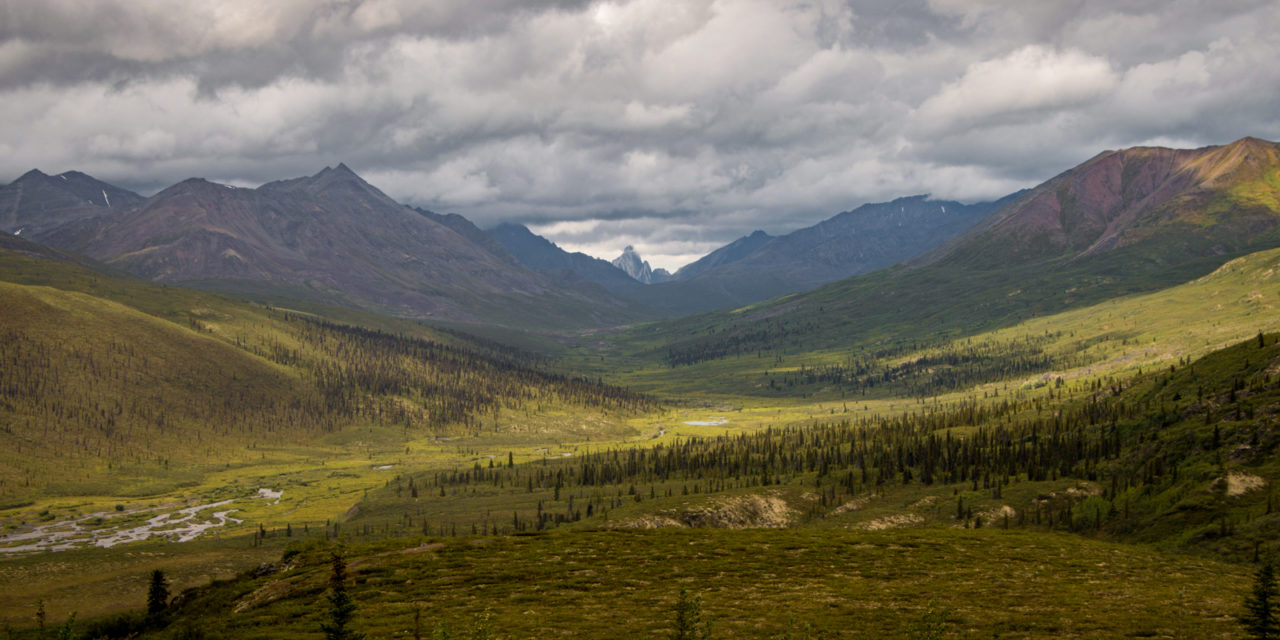
After camping in Fort Nelson, we left all trace of civilization behind. Driving for hours through the green boreal forest, we spotted bears, bison packs, meese, and a cougar, until we finally made it to Watson Lake, the gateway to the Yukon.

Kiskatinaw Bridge
Day 5 to 7 – Whitehorse and surroundings
We spent the night in Watson Lake and then we headed towards Carcross.
Unknown to me, and probably most foreigners in Canada, there are dunes in the middle of the Canadian boreal forest, and the locals refer to the ones at Carcross as the smallest desert in the world. Though we didn’t get the bracing hot weather of a real desert, this unexpected sight was a fun place to walk by the water and climb up the dunes to see the lush around us.
We finally arrived in Whitehorse, the capital of the Yukon, and spent the next two days exploring the city and its surroundings. For anyone interested in learning more about the Gold Rush and its influence on this once isolated city, the Mcbride Museum is worth visiting, as well as the SS Klondike. This sternwheeler for seven years transported prospectors up the river from here to Dawson City.
However, the true treasures of the Yukon are not its cities but its wilderness. Just a couple kilometers off Whitehorse, for example, you’ll find Miles Canyon, where you’ll be able to admire the rapids resembling the white horsehair that give the capital its name.
Outside the city, we visited Kluane National Park, where, apart from spotting bears and foxes, we hiked some of its many trails that took us by lakes, glaciers, and marshes.

A deer at the Yukon Wildlife Preserve. Though the place feels more like a huge zoo, it’s guaranteed you’ll spot wildlife in here.
Days 8 to 11 – Looking for Gold in Dawson City
We continued to Dawson City, a place that seems to be frozen in time. Its history began in 1896 when Carmack found gold in the nearby Bonanza Creek. Once an isolated indigenous territory, Dawson City grew to 40,000 inhabitants in just a couple of years.
However, after the hipe expired, the city was almost deserted. The government, realizing its historical importance, took over the place to prevent it from becoming a ghost town, rebuilding and maintaining its historic structures to make it a tourist destination.
Now, home to a little more than 1300 people from different parts of the world (who mostly travel south during the winter), this gold mining-tourist town has odd characters eager to meet tourists and show them around. Brenda, for example, our Argentinian tour guide, told us that people are crazy because of the high amount of quartz beneath the ground. Also, across the river, people still live without electrical power. And ten years ago, a man without any possessions arrived to leave in a cave; because he’s never bothered anyone, the inhabitants of Dawson City allowed him to stay.
We visited downtown and the many historic buildings, including a bar, a radio station, a camera obscura, and a pub where we could even catch a burlesque show. Then we ventured down to the river to pan for gold. Though the water was freezing cold, I was lucky enough to gather around 20 tiny flakes of gold to take back home with me.
On our last day, we ventured out to Tombstone, a national park taken out from Middle Earth, with golden hills and wildflower plains with ominous dark mountains in the distance. Here, I had the luck to see my first grizzly bear eating berries in the wild.

Dawson City Historical Downtown
Day 11 to 13 – The towns by the water
After our fantastic time in the Yukon, we made our way back to British Columbia, taking the less popular Highway 37. Though it’s not as developed as Highway 97, we were able to see 26 black bears in just one day, which for me, made it up for an endless day of dodging potholes.
Along the way, we passed the Cassiar Mountains, where most of the jade in the world is mined. We camped in Atlin, a town by the lake; Stewart, a village by a river; and Prince Rupert, a city by the sea. Though everything was quiet, all these places were busy tourist destinations during the summer before the pandemic.
Day 14 and 15 – The way back home
Before leaving Prince Rupert, we took a hike in one of the many provincial parks around the city. I was particularly interested in spotting the famous Kermode bears, a subspecies of black bears known for their white fur. Though we didn’t have any luck seeing one, we did spot a regular black bear, and I was satisfied enough to continue our way back home.
We finally entered into familiar territory in Prince George.
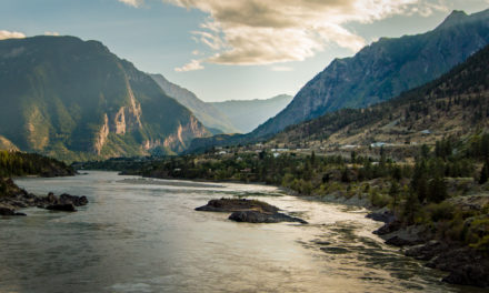
Connected back to the Gold Rush Trail, we visited the town of Lillooet and its famous Old Bridge before taking the Sea to Sky highway. This route took us through Pemberton, Whistler, and Squamish, the mountain towns that welcomed us back home with their west coast green mountain ranges. Finally, after two weeks of adventures, we were happy to get home and put the camping tent away

Stewart Estuary Boardwalk, the perfect place to spot wildlife and take a morning scenic walk between glaciers.
Under Mountains in the Moon Souvenirs
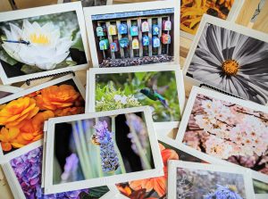
Want to display the Yukon’s wildlife at home?
My travel photography prints and greeting cards make great gifts for all travel lovers!

